Researcher Khalykov Ye.Ye. have passed a research internship from April 16 to May 15, 2018 at the Moscow State University named after M.V. Lomonosov (Russian Federation, Moscow).
The main goal of the internship was study the theoretical, methodological and technological achievements of the integrated mapping laboratory at Moscow State University and ArtGeo, consolidate practical skills in using GIS technology, review scientific and patent literature in the university library, and also have the opportunity to directly communicate with a foreign scientific consultant.
Lectures and practical exercises were attended. Information about gully erosion and the latest methods of studying the gully type relief formation were collected in the library fund of the University. A scientific article was put into publication (Journal of Moscow University Bulletin, series 5, Geography). The skills of ground-based laser scanning in the ultra-long-range Riegl VZ-4000 laser scanner were obtained and practical data processing lessons were learned in the RiSCAN PRO software at ArtGeo. The field data of the gully monitoring sites obtained from the Riegl VZ-4000 laser scanner in the form of cloud points using the RiSCAN PRO program were processed.
One of the methods for recording and evaluating the development of relief-forming processes, which provides quantitative information, is the method of ground-based laser scanning. It allows you to quickly obtain three-dimensional data with high accuracy showing changes in the terrain, characterizing the process of denudation and accumulation.
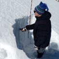
The ravines are one of the most common destructive landforms in the mountains and foothills of the Zhetysu Alatau, located in south-eastern Kazakhstan. Work on the assessment of the dynamics of gully erosion using a scanning device consisted of field and cameral stages. Field work was carried out in 2017. A ground-based three-dimensional laser scanner RIEGL VZ-4000 was used. Two ravines in the valley of the river Mukyr were selected to monitor the gully erosion. The first scan of ravines for quantitative and qualitative assessment of gully erosion. In the future, with repeated surveys of these ravines and the office processing of scan results, detailed indicators of changes in the gully erosion are expected. At the initial stage when processing the scan results as a cloud of points in the RiSCAN PRO program.