Field researches from June 1 to June 26, 2018 under the project “Monitoring studies of adverse exogeodynamic processes of the coastal zone of Alakol lake - areas of intensive recreational development”.
The participants of the expedition: the head of the expedition, Abitbayeva A.D.- Senior Researcher, Valeyev A.G - Researcher, Khalykov Ye.Ye. - Researcher, Bektursinova A.A. - Researcher, Radusnova O.V - Researcher., Togys M.M. - Junior research officer, Uxukbayeva S.A. - Junior research officer, Sharapkhanova J.M. - Junior research officer.
Objection: Alakol lake field researches with the exogeodynamic processes monitoring of six areas of interests in the coastal zone.
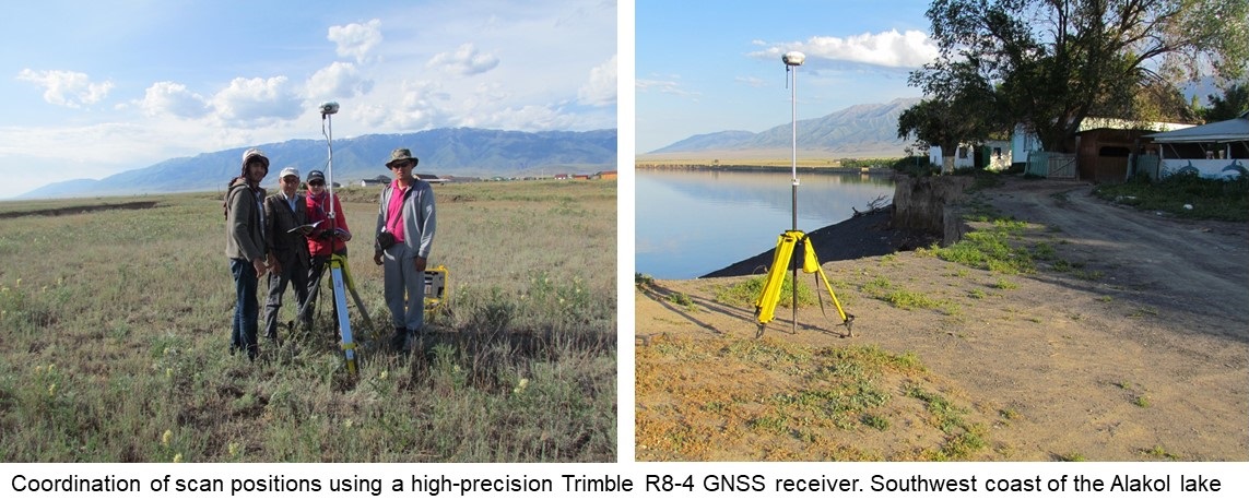
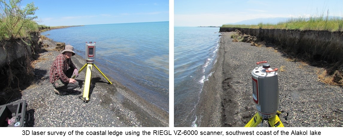
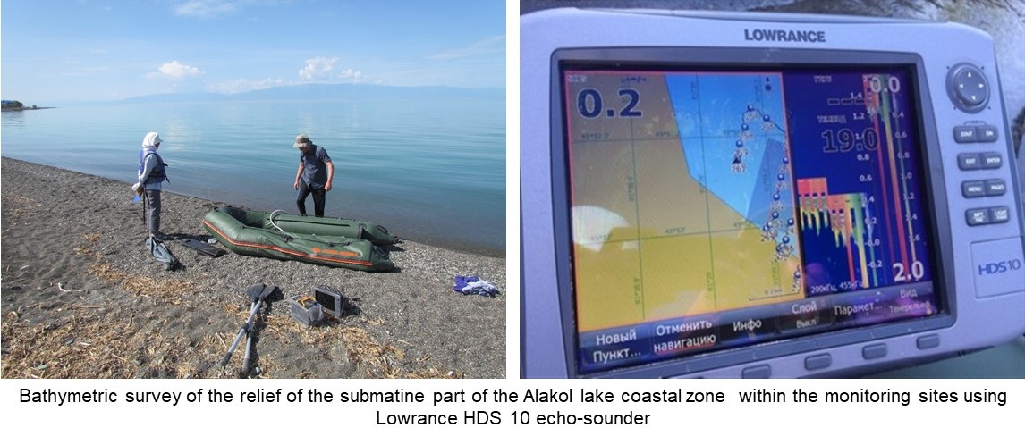
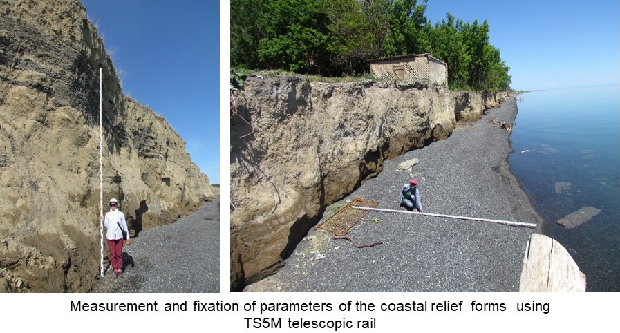
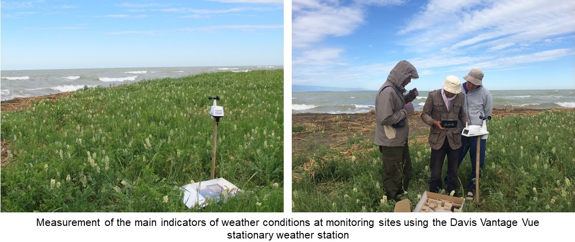
Scientific basis: the field researches are caused by necessity of collecting actual materials of modern exogeodynamic within the Alakol lake coastal zone including the shores with active recreational development. Adapted new and classical methods for the study of coastal formation, including laser scanning, bathymetry, etc. are applied in the expeditionary researches. The following tool measuring equipment such as ground-based 3D laser scanner, high-precision GNSS Trimble R 8-4 coordinate receiver, universal GPS receiver GARMIN GPSMAP 276Cx, Lowrens echo sounder, portable meteorological station, laser rangefinder are used. The collected and processed data was used to solve project issues.
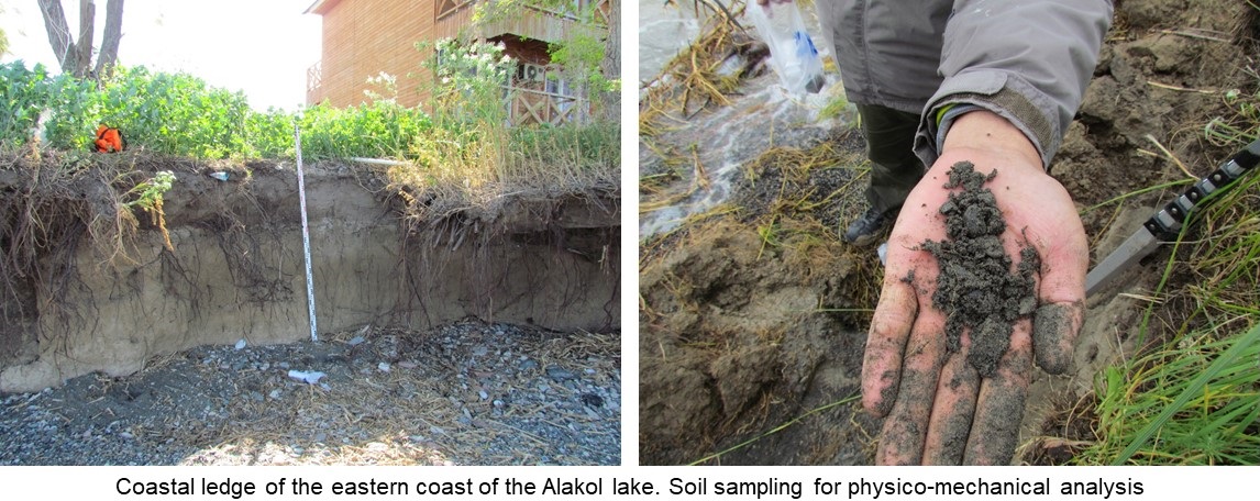
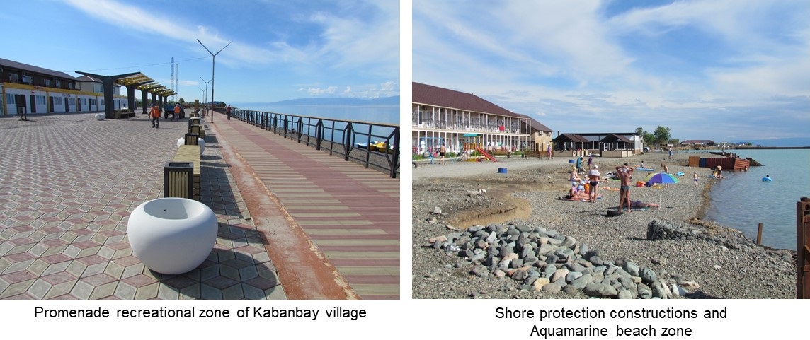
Content of completed types of work: route and seasonal field studies were carried out; monitoring sites, including background areas were selected and organized; soil samples for determination of physical and chemical properties were selected; laser scan survey of abrasive shores by ground-based 3D scanner was carried out; bathymetric survey of the coastal submarine slope was carried out; statistical data of recreational development of the coast were collected; boundaries of relief-forming processes, geomorphology, etc. on maps were specified; main geological and geomorphologic structure features of the Alakol lake coastal zone were highlighted and described; modern development of relief-forming and anthropogenic processes Alakol lake coastal zone were described; correction of cartographic materials was carried out; modern conditions for the further development of the Alakol lake coastal zone recreational potential were identified. morphometric and morphographic characteristics of abrasive shores on key sites were obtained; field notes are compiled; the profiles and schemes of key sites were made.
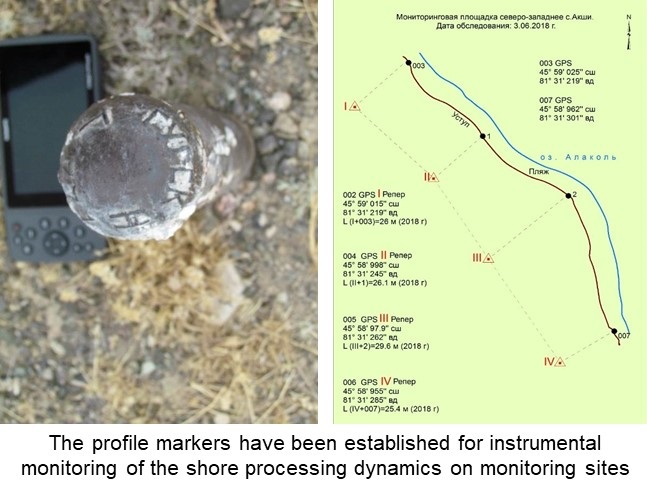
Gathered field work data: parameters and coordinates of abrasive shores for office mapping process are specified by GPS receiver, physical properties of the soil samples from processed results; protrusions of the ledges; cloud points data obtained from abrasive shores laser scanning survey by ground-based 3D scanner; bathymetric map-diagram and submarine coastal slope cross-section profile on key sites; coastal recreational data; engineering-geological map with refined contours of relief-forming processes, lithological properties, etc.; geological and geomorphological structure main features descriptions of the Alakol lake coastal zone; modern development of relief-forming and anthropogenic processes description of the Alakol lake coastal zone; meteorological data for wind-wave conditions analysis of the Alakol lake coastal zone on key areas; schemes of monitoring key areas, field notes; photo gallery of key areas.