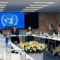
Project manager: Candidate of Geographical Sciences Yegemberdiyeva Kamshat Baratovna.
Project objective: monitoring the natural phenomena and processes of the Charyn SNNP in order to assess their degree of danger and develop measures for the safe use of natural resources.
Expected results:
- 2023: Methodological bases of monitoring of natural hazards and processes in the Charyn State National Natural Park;
- 2024: Assessment of the degree of danger of geological and geomorphological processes, climatic and hydrological phenomena of the Charyn SNNP with a series of assessment maps. Monitoring of natural hazards and processes in the Charyn SNNP by key sites. 1 (one) article and (or) review in a peer-reviewed foreign or domestic publication recommended by the KOKSNVO. 1 (one) article and (or) review in peer-reviewed scientific publications indexed in the Science Citation Index Expanded of the Web of Science database and (or) having a CiteScore percentile of at least 50 (fifty) in the Scopus database;
- 2025: Integrated map of potential sources of hazardous phenomena and processes in the Charyn State National Nature Park at a scale of 1:200 000. Measures for determining the likelihood of occurrence and development of hazardous natural phenomena and processes in the Charyn State National Nature Park. Monitoring of hazardous natural phenomena and processes in key areas of the Charyn State National Nature Park. Two (2) articles and (or) reviews in peer-reviewed scientific journals indexed in the Science Citation Index Expanded of the Web of Science database and (or) having a CiteScore percentile of at least 50 (fifty) in the Scopus database.
The main results obtained:
2023
- Methods of monitoring natural hazards and processes in the Charyn SNNP are defined;
- Key sites for monitoring natural hazards and processes in the Charyn SNNP have been identified;
- A program for monitoring natural hazards and processes in the Charyn SNNP has been developed;
- Monitoring of natural hazards and processes in the Charyn SNNP was carried out in key areas.
2024
- Assessment of the degree of danger of climatic phenomena in the Charyn SNNP was carried out;
- Monitoring of natural hazards and processes in the Charyn SNNP was carried out in key areas;
- Assessment of the degree of danger of hydrological phenomena of the Charyn SNNP was carried out and an assessment map was compiled using GIS;
- Assessment of the degree of danger of geological and geomorphological processes of the Charyn SNNP was carried out and an assessment map was compiled using GIS;
- 1 (one) article has been published in a peer-reviewed Russian publication recommended by the KOKSNVO;
- 1 (one) article has been published in peer-reviewed scientific publications in the Scopus database with a CiteScore percentile at least 50 (fifty).
2025
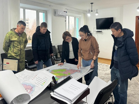
- An integrated map of potential sources of dangerous phenomena and processes of the Charyn SNNP on a scale of 1:200 000 has been developed;
- Monitoring of natural hazards and processes in the Charyn SNNP is carried out at key sites;
- Measures will be developed to determine the possibility of occurrence and development of dangerous natural phenomena and processes of the Charyn SNNP for the safe use of natural resources and management decisions;
- A map of measures will be created to determine the possibility of occurrence and development of dangerous natural phenomena and processes in the Charyn SNNP;
- 2 (two) articles and / or reviews will be published in peer-reviewed scientific publications indexed in the Science Citation Index Expanded of the Web of Science database and (or) the Scopus database with a CiteScore percentile at least 50 (fifty).
Published:
1. Sharapkhanova Zh.M., Lyy Y.F., & Yegemberdiyeva K.B. Assessment and mapping of the mudflow phenomena intensity in Charyn State National Natural Park // Geojournal of Tourism and Geosites, 2024. – vol. 55, no. 3. – P. 1148–1155. https://doi.org/10.30892/gtg.55315-1287. CiteScore 3,9/ SJR 0.323/ SNIP 0.699, Q3, 65- percentile.
2. A. D. Abitbayeva, A. A. Bektursynova, Zh. М. Sharapkhanova, K. B. Yegemberdiyeva. Assessment and mapping of the degree of danger of geological and geomorphological processes of the Charyn SNNP //Geography and water resources. Almaty, 2024, No. 3, pp. 58-67. https://doi.org/10.55764/2957-9856/2024-3-58-67.26.
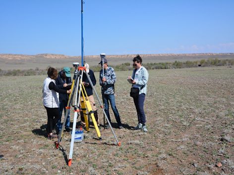
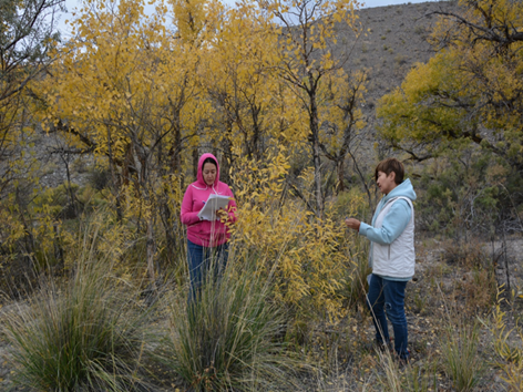
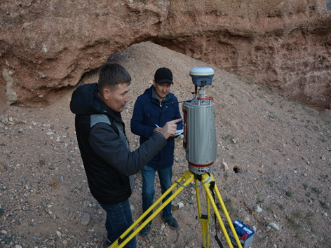
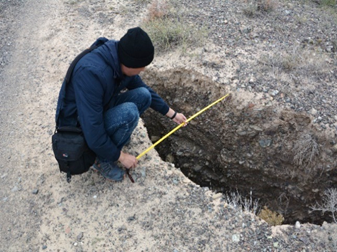
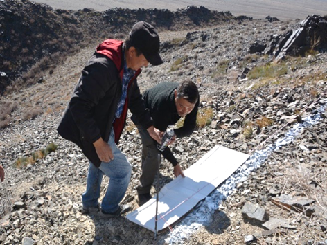
Field research: the purpose of monitoring conducted on the territory of the Charyn SNNP is to monitor the dynamics of development of natural hazards and processes, as well as to develop recommendations and management decisions aimed at preventing and reducing their negative consequences. Field research tasks include monitoring of natural hazards and processes at 12 key sites selected within the Charyn SNNP. The methods used are based on instrumental measurements using high-precision equipment: SOUTH Galaxy G9 and Trimble GNSS receivers, Riegl VZ-4000 ground-based laser scanner, an Autel Robotics EVO 3 unmanned aerial vehicle, and a laser rangefinder.
Link to social networks
Instagram page:
https://www.instagram.com/geotourism_geomorphology?igsh=bGVydGZ0eXM5b2Nl
Facebook page: