Field research on the project
"Geographical bases for managing agricultural development lands in Zhambyl region under the conditions of water resources limitation".
The composition of the research team: senior researcher Krylov V. S., chief researcher Basova T. A., senior researcher Makanova A. U., junior researcher Kuderin A. A., junior researcher, Omarov A. N.
Trip date: from July 10 to August 11, 2018
The purpose of the research: Conducting field research to assess the land and water resources of Zhambyl region
Tasks:
- carrying out adjustment of contours of used and cultivated agricultural land;
- identification of sources of watering for agricultural lands and assessment of their condition;
- conducting research on the degradation of irrigated and pasture lands in the Zhambyl region, identifying disturbed lands.
A group of landscape scientists of LLP "Institute of geography" in the period from July 10 to August 11, 2018 conducted a field survey of land and water resources of Zhambyl region.
The routes were designed to survey the land used in crop and livestock production in different regions of the region. Thus, the lands involved in agriculture, located in different natural conditions - river complexes, sand massifs and foothills.
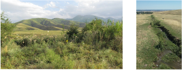
Foothill plains traditionally used as pastures (near Taldybulak village, Merki district)
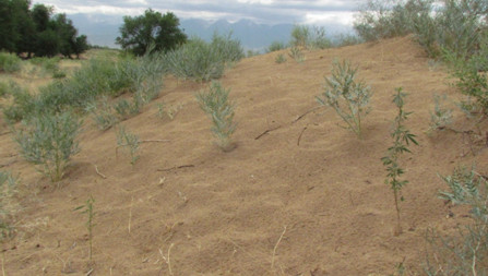
Pre-sand zone of the Moynkum massif used for livestock grazing (near Akyrtobe, T. Ryskulov District)
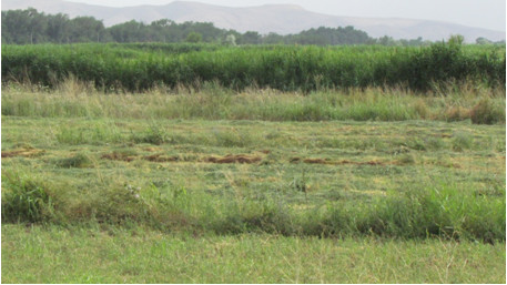
Natural hay land along the river Kurahatti (Merki district)
River valley of the river Assy, used for grazing (near Birlesu-Enbek, Zhambyl district)
According to the program of field survey were clarified and described the types and contours of agricultural land (pasture, arable land) and their productivity, identified the sources of their flooding.
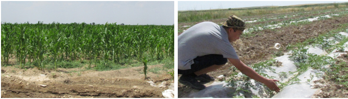
Growing corn and plantations (irrigation by hand-dug furrows)
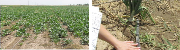
Growing beets and onions (drip irrigation)
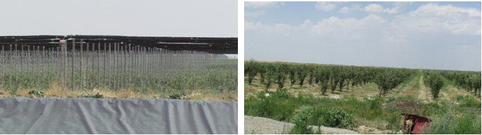
Garden cultivation (on the left - by modern technology "turnkey garden", on the right-traditionally)
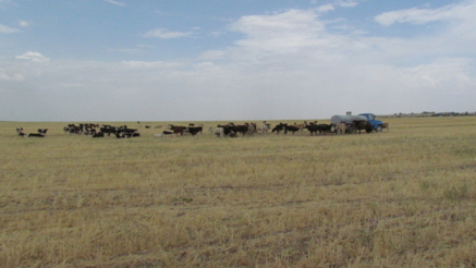
Cattle grazing on the harvested cereal field with water supply for watering (Shu district)
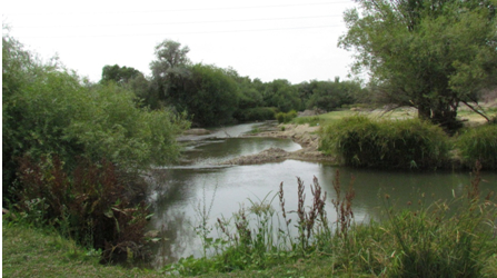
Particular attention was paid to the sources of watering. These include all the major rivers of the region, as well as a network of channels designated for irrigation. During the work examined the condition of the shorelines of rivers and channels, etc.
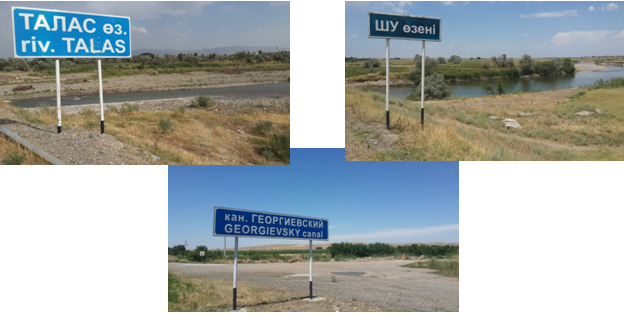
A separate point of the survey was a visit to the Tasutkol reservoir and the main canal (MC) diverted from it, flooding irrigation arrays of the Shu district.
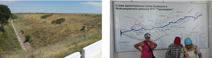
Dam of Tasutkol Reservoir Scheme of irrigation networks
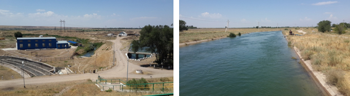
View from the dam on the Tasutkel MC Pumping installations along the Tasutkel MC
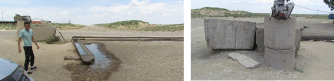
Typical organization of watering in the farms of the region
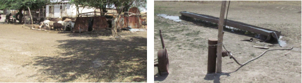
Farmer manor, in the past organized wintering near the well, with a place for watering livestock (Baizak district)
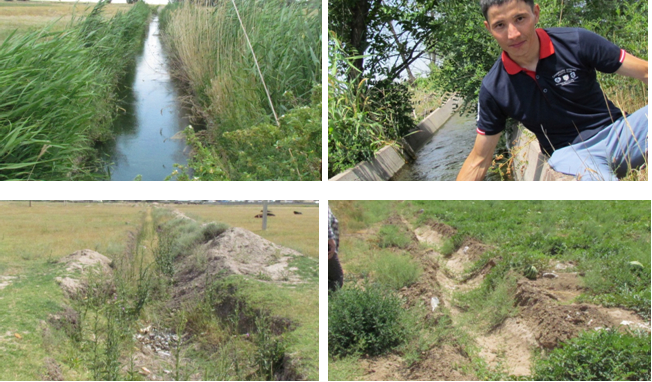
The condition of the aryks of the region is mainly favorable, they are full-flowing. But there are also destroyed and abandoned aryks (in earthen beds).
Also, as a result of the measurements, the data on pasture yields, fodder capacity, and fodder stock were refined. All this together allowed us to determine the nature of the disturbance and the degree of vegetation degradation.
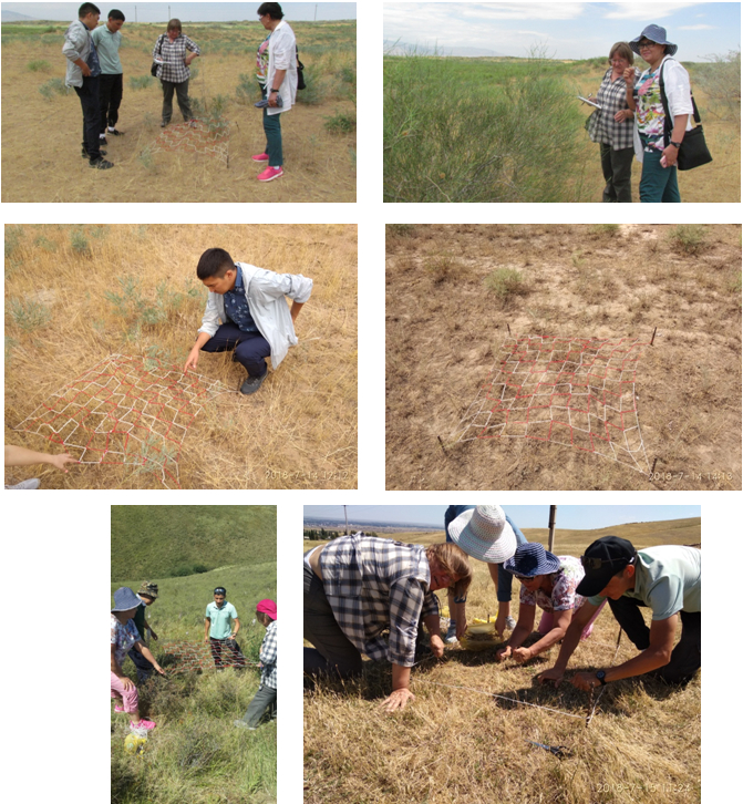
An example of using the Ramensky grid to determine the yield of vegetation of sand massifs and foothills.
A total of 51 points were surveyed. In the course of the work, forms of a geobotanical description were filled for both arable lands and pastures, as well as irrigation points and irrigation sources were described.
There were also recorded cases of anthropogenic pollution that adversely affect the ecological state of land and water resources.
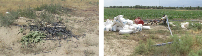
Plastic hoses of irrigation systems Violation of the rules of storage and fertilization
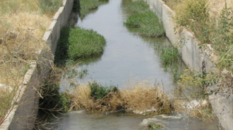
Siltation of irrigation canals and untimely cleaning
According to the results of the expedition surveys, the research objectives and tasks were fully implemented in accordance With the program of the field study of the project " Geographical basis of land management of agricultural development of Zhambyl region in conditions of water resources limitation»:
- corrected contours of used and cultivated agricultural lands;
- the sources of watering for agricultural lands (pasture and irrigated arable lands) are established and the associated assessment of their condition is carried out;
- a complex of works on the study of degradation on irrigated and pasture lands of Zhambyl region and identification of disturbed lands was carried out.
The results obtained during the processing of the field materials were reflected in the interim and final reports on the project theme.