 | Head of the Laboratory – Kamshat Baratovna Yegemberdiyeva, Candidate of Geographical Sciences
E-mail: kamshat.yegemberdiyeva@gmail.com |
History of the Laboratory
Laboratory “Geotourism and geomorphology” was established in January 2022 through the merger of two laboratories: “Geomorphology and GIS cartography” and “Tourism and recreation geography”.
The Laboratory of “Geomorphology and GIS cartography” was founded in August 1991 on the initiative of the Institute's director, Professor N.K. Mukitanov and the deputy Director A.R. Medeu based on the Laboratory of Physical Geography and the sector of Geomorphology of the K.I. Satpayev Institute of Geological Sciences. The first head of the laboratory, who determined its main development paths, directions of fundamental and applied researches was E.I. Nurmambetov.
Thematic research on recreation and tourism issues has been conducted at the Institute of Geography since 1996 led by Cand. of Geogr. Sc. V.I. Popov until 2003. In 2003, the Laboratory of Recreational Geography was merged with the Laboratory of Mountain Areas Geoecology under supervision of Dr. of Geogr. Sc. V.P. Blagoveshchenskiy and was renamed the “Laboratory of Geoecology of Mountain Areas and Recreational Geography”. In 2008 the “Laboratory of Tourism and Recreational Geography” was formed due to the expansion of the range and quantity of work.
The laboratory of “Geotourism and geomorphology” conducts theoretical, methodological, experimental and applied research in the budget, targeted and grant (domestic and foreign) funding, as well as organized practical training for undergraduate and graduate students in “Tourism”, “Cartography” and “Geoinformatics”.
Scientific areas
1) The Study of theoretical and methodological foundations of development and management of the tourism industry;
2) Development of an inventory of natural, cultural-historical and socio-economic tourist objects of Kazakhstan;
3) Introduction and development of information support for the implementation of national and regional programs of tourism industry development in Kazakhstan;
4) Study of ecological tourism as a factor of sustainable development of tourism in Kazakhstan.
5) Study of modern natural-anthropogenic relief-forming processes;
6) Monitoring of hazardous geomorphological processes: moving sands, abrasion of coastal cliffs, gully erosion, landslide processes etc.;
7) Ecological and geomorphological studies of natural and economic systems for rational land use;
8) Risk assessment of emergence and development of dangerous exogenous processes;
9) Studying the role of geomorphological processes in activation of desertification;
10) Geoinformation thematic and atlas mapping of the relief environment;
11) Scientific analysis of etymology and transliteration of restored historical geographical names.
Staff capacity
Currently, 13 employees work at the laboratory, including 3 Candidates of Sciences, 2 PhDs, 4 PhD student and 4 Masters. The specialists have international certificates confirming their competence in the application of GIS-technologies and remote sensing materials, inter- and transdisciplinary scientific research.

Obtained scientific results:
The Laboratory of Geotourism and Geomorphology carried out three major projects:
1. Project "Integrated assessment of ecosystems of the Shchuchinsk-Borovskaya resort area with the determination of the ecological load for the sustainable use of recreational potential" (Sciense Commitee of the MES RK);
2. Project "Development of scientific and applied foundations for ensuring water security of the Republic of Kazakhstan in the transboundary Aral-Syrdarya basin until 2050" for 2021 research on analysis of demographic situation and types of water supply of the Aral-Syrdarya basin population and assessment of natural conditions and socio-economic development of the North Kazakhstan region in the context of population relocation from the Aral-Syrdarya basin were conducted.
3. Project "Cadastral assessment of the current ecological state of flora and plant resources of the Almaty region as a scientific basis for the effective management of resource potential" for 2021 Maps of rare flora species, rare plant communities, and potential locations of rare flora species for Karasay, Talgar, Enbekshikazakh, Uigur, Kegen, Raiymbek, Panfilov districts of Almaty region were created at 1:5 000 000 (paper version) and 1:1 000 000 (interactive map) scales.
A number of projects were also carried out:
- comprehensive environmental studies on the territory of Shchuchinsk-Borovoye Resort Area to determine ways of sustainable development (MEP RK);
- development of natural-science rationale of Turkestan State National Nature Park and the Kyzylkum State Nature Reserve (World Wildlife Fund (WWF);
- development of the science rationale for the expansion of Sairam-Ugam State National Nature Park (“ATPG Kazakhstan” LLP);
- development of the Sustainable Land Use Strategy for the Ile-Balkhash and Aral-Syrdariya Project Areas (GEF/UNDP/Government of the Republic of Kazakhstan);
- creation of the “Ancient cities of Kazakhstan” interactive map in Kazakh, English and Russian languages (the Kazakh National Geographic Society with the support of ERG, KAZ Mineralsple and Kazakhmys Corporation LLP);
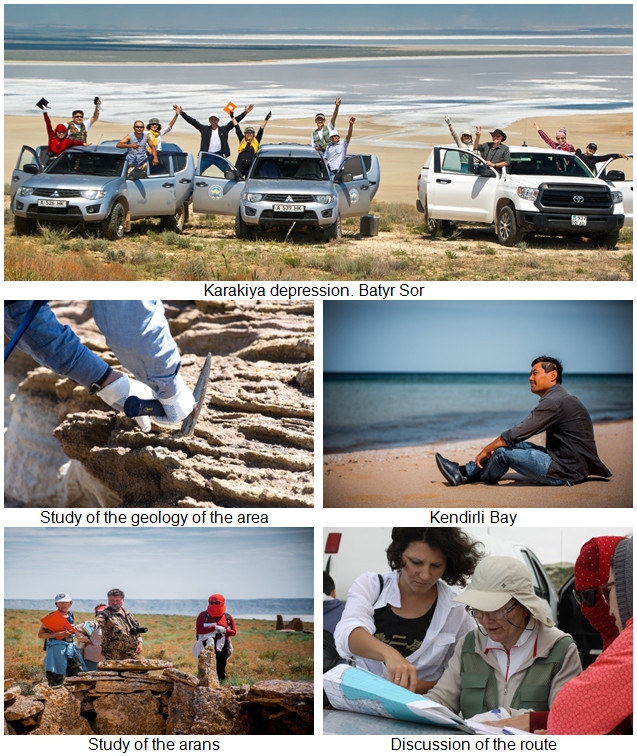
- development of passports of unique natural sites of the Mangystau region” (Department of Natural Resources and Environmental Management of the Mangystau region);
- development of scientific and technical feasibility study of the maximum possible options for Eurasian transit through the territory of Kazakhstan (SC MES RK);
- creation of a scientific interactive historical map “People of Kazakhstan” (SC MES RK) (the map is available on the site of the Assembly of the People of Kazakhstan at: http://assembly.kz/);
- development of methodology for mapping and creation of database of recreational and tourist-recreational resource potential of the Lakes Atlas (Committee on Water Resources of the Ministry of Agriculture of the Republic of Kazakhstan);
- creation of the Atlas of Kyzylorda region and interactive maps based on GIS-technologies (ISC"Astana");
- “Integrated Assessment of Ecosystems of the Shchuchinsk-Borovoye Resort Area with the determination of the environmental load for the sustainable management of recreational potential” (SC MES RK);
- management of tourism resources based on WEB-technologies on the example of North Kazakhstan (SC MES RK);
- scientific and applied fundamentals of tourism resources management on the basis of Web-technologies on the example of Northern Kazakhstan;
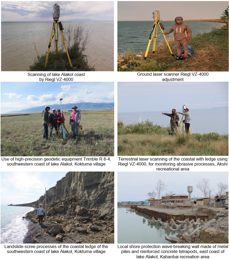
- monitoring studies of unfavorable exogeodynamic processes in the coastal zone of Lake Alakol, the territory of intensive recreational development (SC MES RK);
- compiling a map of the distribution of essential oil-bearing plants in the South Kazakhstan region with the geodatabase in the ArcGIS Explorer program (“Silkway” International University);
- development of zoning and landscape planning schemes for sustainable management of key biodiversity areas in 7 pilot districts of Almaty region (UNDP in Kazakhstan);
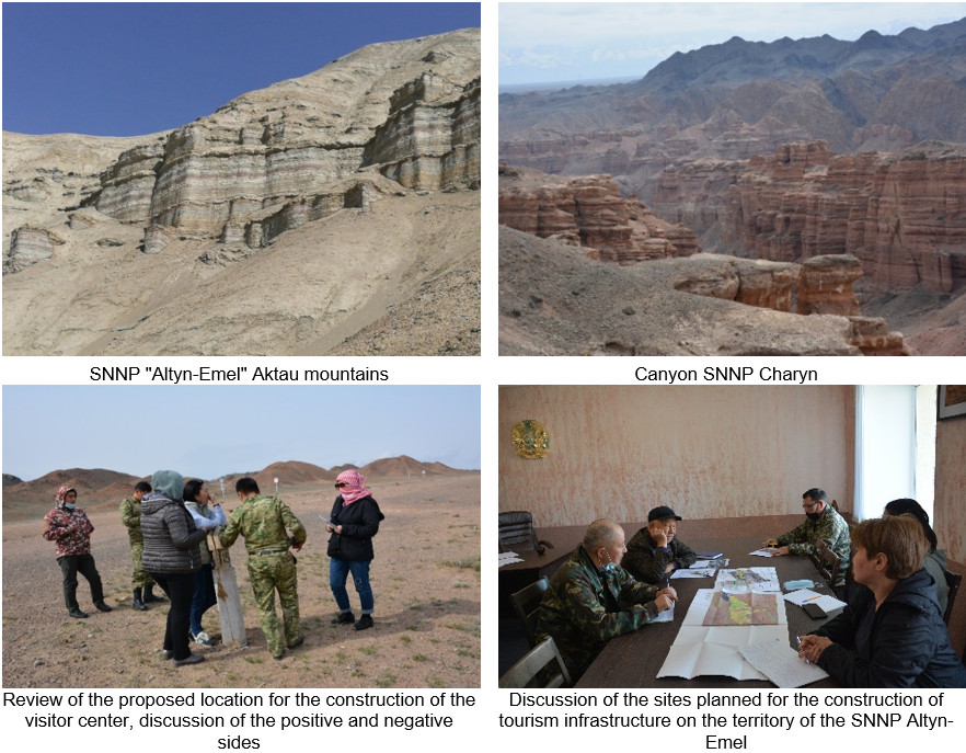
- preliminary assessment of the impact of planned activities on the environment for the tourism infrastructure development in SNNP Altyn-Emel and SNNP Charyn (the Kazakh National Geographic Society).
Prospects of development
The scientific works of the staff is related to new areas of theoretical-methodological and applied researches, which are important for sustainable development of natural and economic systems, safety of life of the population, the development of tourism industry of the Republic of Kazakhstan. They include:
- development of theoretical and methodological bases of tourism industry research with application of world experience, including development of methods of tourist potential assessment, determination of recreational capacity and permissible recreational loads;
- development of Strategies and Concepts for the development of tourism in the country and/or regions of the Republic of Kazakhstan;
- development of a natural-scientific and feasibility studies for creation, expansion, ways of reorganization and development strategies of specially protected natural areas;
- creation of a scientifically based description of the relief features of natural objects, assessment in terms of nature management safety, and the possibility of using their unique features as tourist attractions
- monitoring, risk assessment, modeling of possible development of dangerous geomorphologic processes: moving sands, abrasion, mudflows, landslides, rockslides, karst, suffusion etc.
- ecological-geomorphological researches in the areas of intensive economic development;
- development of passports of natural, cultural-historical and socio-economic tourism facilities of Kazakhstan in the unified database (cadastre);
- development of reference tourist routes at republican, regional and local levels, justification of peculiarities of their organization, marking, provision with infrastructure elements taking into account available geomorphological peculiarities of the territory;
- creation of the national Tourist Atlas on the basis of unified cadastre of tourism facilities of the Republic of Kazakhstan;
- GIS thematic and atlas cartography of relief environment, modern natural-anthropogenic relief-forming processes in Kazakhstan (SC MES RK);
- GIS- and Web-support (interactive tourism map) in order to increase and develop productivity by automating researches in the tourism industry and popularization of the regions of Kazakhstan on a global scale.
Main publications
Articles or reviews in journals indexed by Web of Science Core Collection or Scopus:
- Valeyev Adilet, Marat Karatayev, Ainagul Abitbayeva, Saule Uxukbayeva, Aruzhan Bektursynova and Zhanerke Sharapkhanova. Monitoring Coastline Dynamics of Alakol Lake in Kazakhstan Using Remote Sensing Data // Geosciences. MDPI, Switzerland. 2019, Volume 9, Issue 9, 404; doi:10.3390/geosciences9090404 https://doi.org/10.3390/geosciences9090404 . (импакт-фактор IF 1,82, Q2 (Scopus)) Процентиль 81.
- Yegemberdiyeva K., Khen A., Yushina Yu., Temirbayeva R., Orazbekova K. Assessment of the natural-recreational resources of the Akmola Region (Based on the Example of the Shchuchinsk-Borovoye Resort Area) for the Purpose of Sustainable Development of Tourism // GeoJournal of Tourism and Geosites, 2020. – vol. 30, no. 2. 818-826. DOI: 10.30892/gtg.302spl06-510. Процентиль по Cite Score 64.
- Khalykov, Y., Lyy. Y, Sarybaev, E., Uksukbayeva, S., Sharapkhanova, Z. Study of conditions of gully formation in mountain regions of south-east Kazakhstan with use of GIS-technologies // Geodesy and Cartography (Vilnius). – 2021. – 47(2). – С. 54-65.
- Madimarova G., Suleimenova D., Pentayev T., Khalykov Y., Baydauletova G., Tumazhanova S., Stankova H. The geodetic monitoring of deformations of a highrise building using ground-based laser scanning technology / Journal of Applied Engineering Science. – Vol. 20, No. 4, 2022 P. 1083-1092. DOI:10.5937/jaes0-37001 (Scopus: CiteScore JCR – Q2, 52-процентиль).
- N. Zinabdin, F. Akiyanova, K. Yegemberdiyeva, R. Temirbayeva, O. Mazbayev. The Functional Zoning of the Syr Darya River’s Delta // Sustainability (Switzerland). – 14(12),7153. – 2022. DOI 10.3390/su14127153 Импакт фактор журнала – 3,251 Рейтинг журнала: JCR – Q2 (науки об окружающей среде). Процентиль 85.
Articles or reviews in journals recommended by the Commetee for Quality Assurance in the sphere of Education of the ME RK
- Valeyev A.G., F.Zh. Akiyanova, A.D. Abitbayeva, Ye.Ye. Khalykov, M.M. Togys. Development of abrasion shores of Alakol lake according to the field research materials / News of the National Sciences Academy of the Republic of Kazakhstan. Geology and Technique sciences part. Almaty, 2019. – №. 1 – pp. 195-205. Open Source (Impact Factor: SJR (0,19); Scopus CiteScore (0,09); SNIP (0,011)). (импакт-фактор IF 0,09 (Scopus)). Процентиль 24.
- Valeyev A.G., Abitbayeva A.D., Mitrofanova A.N., Khalykov Ye.Ye., Togys M.M., Uxukbayeva S. А., Sharapkhanova Zh. M. Tourist and recreational potential of Lake Alakol // Issues of geography and geoecology. – Almaty, 2019. – №3. – С. 3-11.
- Temirbayeva R.K., Orazbekova K.S., Azhirov N. A. Modern demographic processes of the North Kazakhstan region // Issues of geography and geoecology. – Almaty, 2021. – №3. – С. 59-65./li>
- Orazbekova K.S. Assessment of tourism potential and mapping of hydrological resources of the Akmola region // Issues of geography and geoecology. – Almaty, 2020. – №2. – С.96-102.
- Temirbayeva R.K., Yegemberdiyeva K.B., Orazbekova K.S., Yushina Yu.A, Khen A.P., Azhirov N.A. Tourist routes o f the State National Natural Park “Burabay”// Issues of geography and geoecology. – Almaty, 2020. – №3. – С. 91-98.
- Zh. Khaibullina, A. Amantaykyzy, D. Ariphanova, R. Temirbayeva, A. Mitusovs, Zh. Zhurumbetova. The impact of climate change and water availability on socio-economic aspects and public health in the Aral region of the Kyzylorda region, Kazakhstan // Central Asian Journal of Water Resources Research (2022) 8(2): 79-111. – ISSN: 2522-9060. DOI: 10.29258/CAJWR/2022-R1.v8-1/79-111.rus.
Participation in conferences
- Yushina Yu., Yegemberdiyeva K. Assessment of tourism and recreational potential of climatic resources of the Akmola region (Kazakhstan) //XIX International Multidisciplinary Scientific GeoConference SGEM (28 June – 7 July). – 2019.
- Bektursynova A.A., Mitrofanova A.N., Kalita R.Sh., Valeyev A.G., Abitbayeva A.D. Assessment of natural and anthropogenic factors of recreational development of the coastal zone of Lake Alakol // Anthropogenic transformation of geospace: nature, economy, society. Materials of the V International Scientific and Practical Conference, October 1-4. – Volgograd, 2019 – 390-395.
- Yegemberdiyeva K., Temirbayeva R., Orazbekova K., Khen A., Yushina Yu. Management of tourist resources based on the use of Web-technology on the example of the Akmola region, the Republic of Kazakhstan //XXth International Multidisciplinary Scientific GeoConference SGEM (16-25 August). – 2020.
- Ye. Khalykov, Yu. Lyy, A. Abitbayeva, M. Togys, A.Valeyev. Terrestrial laser scanning method for monitoring erosion of the southwestern shore of Alakol lake // 20th International Multidisciplinary Scientific GeoConference Surveying Geology and Mining Ecology Management SGEM. – Bulgaria, Albena. – 16.08–25.08.2020.
- A. Abitbayeva, Yu. Lyy, A.Valeyev, R. Kalita, A.Mitrofanova. Classification of Alakol lake coastes by prevailing exogeodinamic processes and recreational conditions // 20th International Multidisciplinary Scientific GeoConference Surveying Geology and Mining Ecology Management SGEM. – Bulgaria, Albena. – 16.08–25.08.2020.
- Liy Yu. F., Halykov E. E., Togys M. M., Sarybaev E. S., Aliken E. G. assessment of the favorable conditions of population settlement on the terrain of the North Kazakhstan region using GIS technology // Vestnik kaznu. The series is geographical. Volume 68. №1.2023.
Monographs
- Temirbayeva R.K., Akiyanova .Zh., Karynbayev A.K., Ospanbayev Zh.O., Yegemberdiyeva K.B., Budnikova T.I., Sharapkhanova Zh.M. // Strategy and Action Plan for Sustainable Land Use in the Ile-Balkhash Project Area. – Astana, 2017 – p. 85. ISBN 978-601-7882-27-3.
- Temirbayeva R.K., Akiyanova Zh., Karynbayev A.K., Ospanbayev Zh.O., Yegemberdiyeva K.B., Budnikova T.I., Sharapkhanova Zh.M. // Strategy and Action Plan for Sustainable Land Use in the Aral-Syrdariya Project Area. – Astana, 2017 – p. 116. ISBN 978-601-7882-27-3.
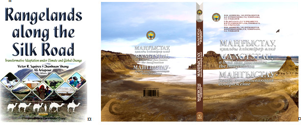
- Akiyanova , Temirbayeva R., Karynbayev A. and Yegemberdiyeva K. Assessment of the scale, geographical distribution and diversity of pastures along the Kazakhstan’s part of the route of the great Silk Road // Book Title: Rangelands along the Silk Road: Transformative Adaptation under Climate and Global Change. (Eds.: Squires V., Shang, Ariapour). – NOVA, New York, 2017. – 389 p. ISBN 978-1-53610-612-1 (e-book).
- Yegemberdiyeva, R.K. Temirbayeva, O.A. Tokzhanov et.al. Mangystau, a land that fascinates the imagination: monograph / Chief Editor A.R. Medeu; Institute of Geography. – Almaty, 2019. – p. 304. ISBN 978-601-7150-93-8. (in-print).
Expeditions and field research
Field researches of the regions of Kazakhstan were carried out at different times within the framework of projects funded by domestic and foreign customers. Among the most important, the following ones can be highlighted:
Development of passports of unique nature sites of the Mangystau region
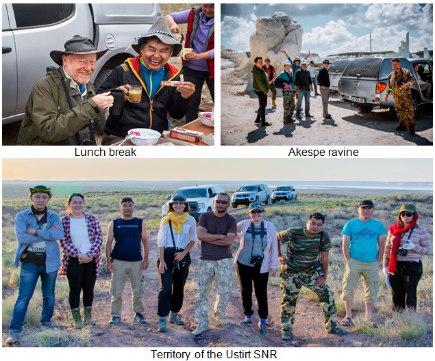
Field research in the framework of the project on the “Scientific study for the expansion of the Sairam-Ugam SNNP”

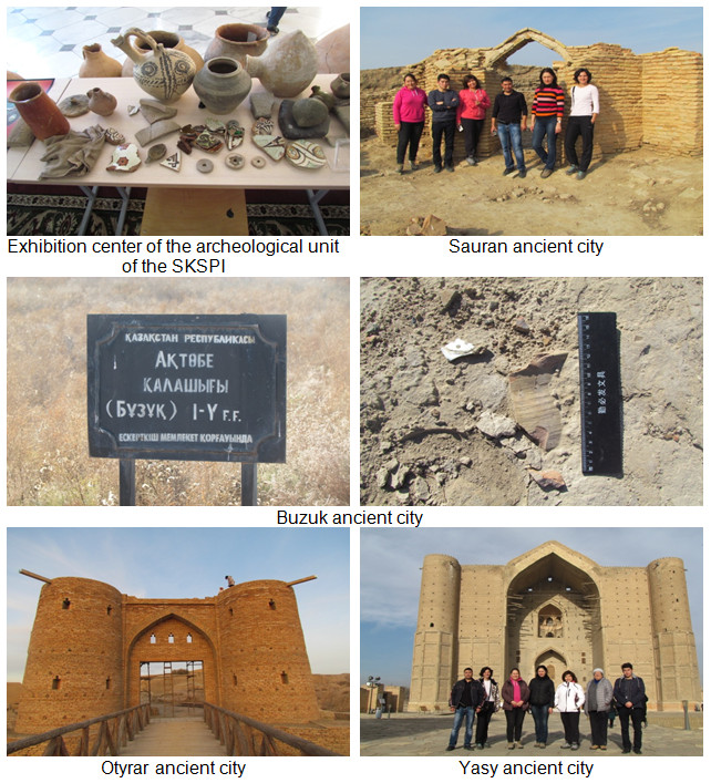
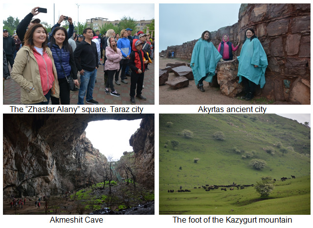
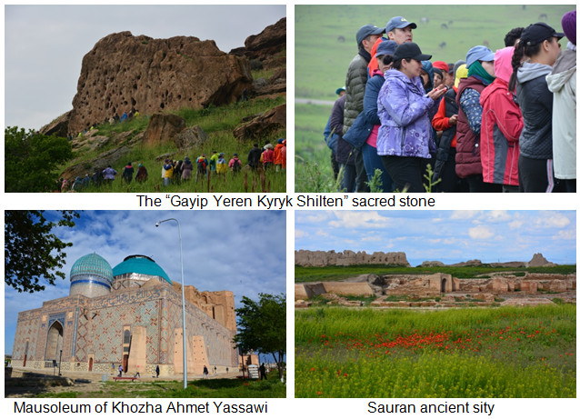
Field research in the framework of the project on “Geography of ancient cities of Kazakhstan”
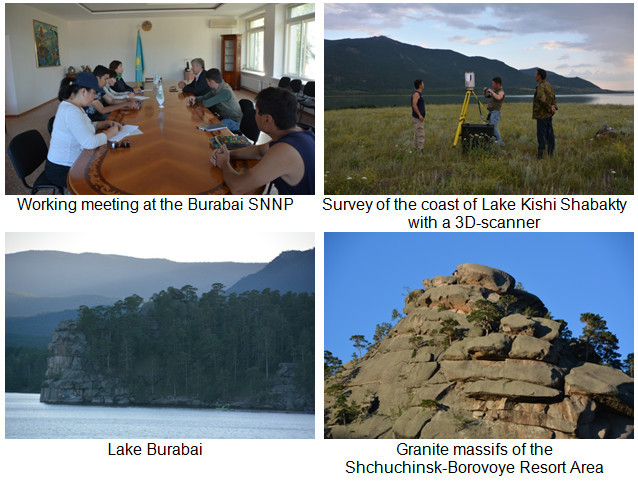
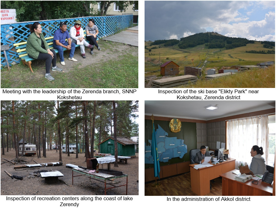
Integrated assessment of the ecosystems of the Shchuchinsk-Borovoye Resort Area with the determination of the environmental load in order to sustainably use the recreational potential
Field research in the framework of the project on “Scientific and applied bases of management of tourism resources based on WEB-technologies using the example of North Kazakhstan”
The “Legends of the South” expedition
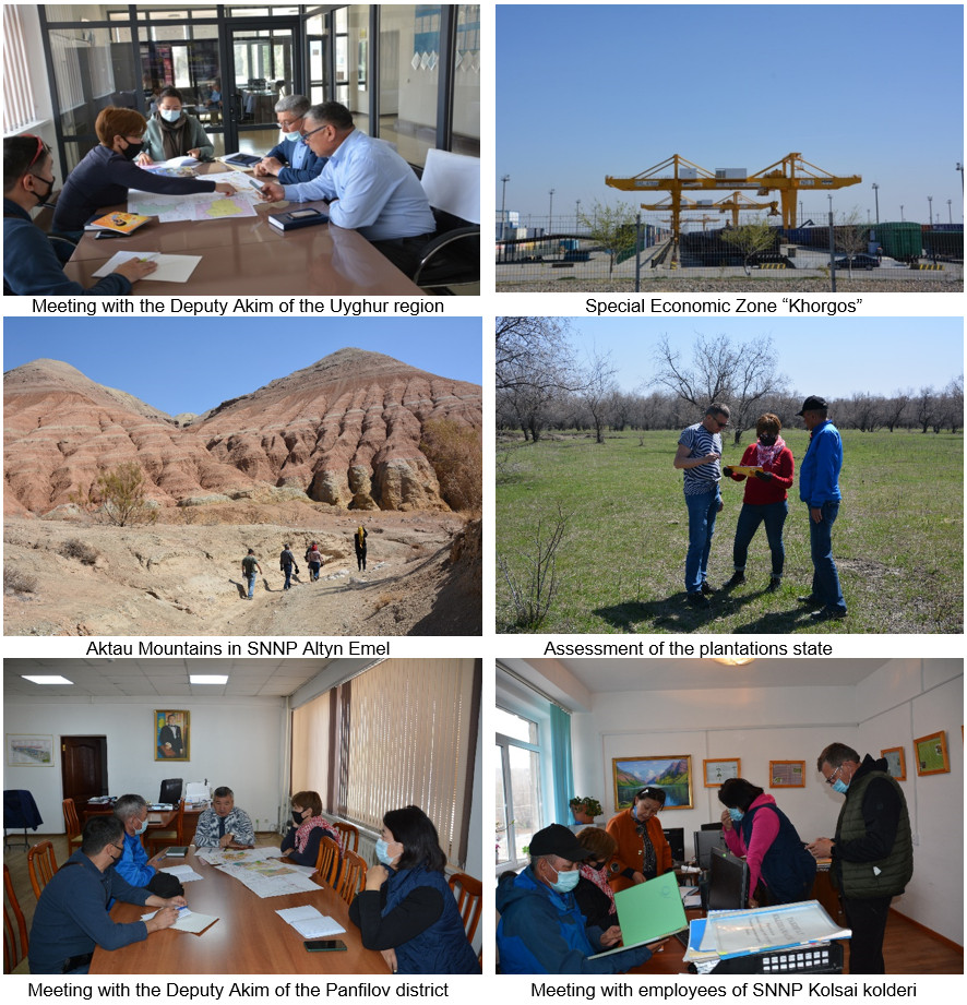
Development of zoning and landscape planning schemes for sustainable management of key biodiversity areas in 7 pilot districts of Almaty region
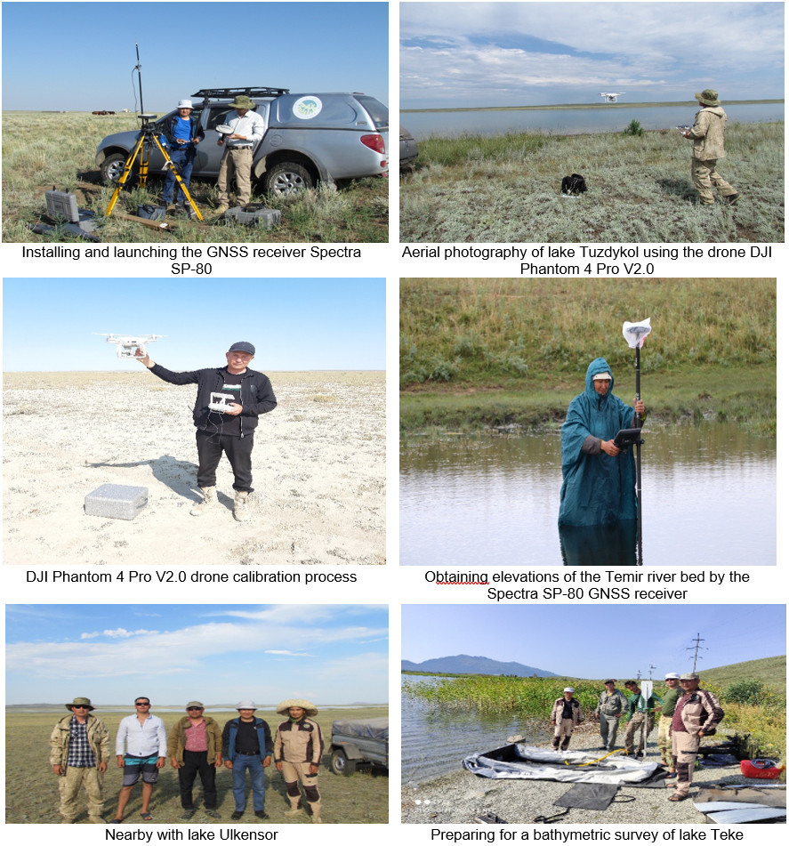
Development of passports for small lakes and rivers of Kazakhstan
Preliminary assessment of the territory for the development of tourism infrastructure in SNNP Altyn-Emel and SNNP Charyn