BUSINESS TRIP REPORT OF EMPLOYEES OF THE LABORATORY GEOGRAPHICAL INFORMATION SYSTEMS – INTERNATIONAL FORUM "SPACE DAYS IN KAZAKHSTAN: BAIKONUR IS CRADLE OF THE WORLD COSMONAUTICS»
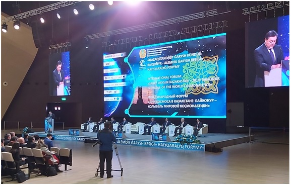
In November 12-13, 2019, the international space forum "Space days in Kazakhstan: Baikonur is cradle of world cosmonautics", organized by the Aerospace Committee of the Ministry of Digital development, Innovations and Aerospace Industry of the Republic of Kazakhstan, was held in the Congress center EXPO in Nur-Sultan.
The international forum "Days of space in Kazakhstan" has been held annually since 2013. The current event at the opening of the forum was attended by Prime-Minister of the Republic of Kazakhstan Askar Mamin, also 650 participants from more than 25 countries - heads of the Ministry of Digital development, Innovation and Aerospace Industry of Kazakhstan, deputies of the Senate and Majilis of the Parliament of Kazakhstan, cosmonauts of the Republic of Kazakhstan, representatives of foreign embassies, "Roscosmos Corporation", "Airbus Defence and Space", domestic and foreign organizations: "Khrunichev State Research and Production Space Center", JSC "Information Satellite Systems - M.F. Reshetnev", "TransTeleCom", "One Web", "Thales Alenia Space", SES, "Leica Geosystems, Satrec Initiative", "Eutelsat", etc.
From Institute of Geography to participate in the forum were sent employees of laboratory geographical information systems: candidate of geographical sciences Karagulova R. and researcher Iskaliyeva G.
The forum discussed the further development of the Baikonur space complex, effective use of the results of space activities to solve the problems of economic sectors, the results of Kazakhstan's space activities over the past decade, also prospects for international cooperation and development of the industry.
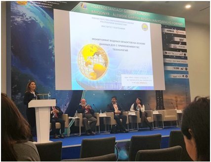
The forum was held in three directions: Baikonur Cosmodrome: Resetting; Remote Sensing from space and satellite navigation; the Future of satellite communications. Plenary sessions on various topics were organized under the block "space and satellite navigation technologies". On the first day the head of the laboratory geographical information systems, candidate of geographical sciences Karagulova R. made a report on "Monitoring of water bodies based on remote sensing data using GIS technology" at the plenary session "Experience of using data from space shooting and geoinformation technologies in monitoring water objects at the territory of Kazakhstan", where she told about the experience of the Institute of geography in the use of satellite images in the research papers and the results of the work performed on monitoring of water objects on the basis of data remote sensing data using GIS technology.